North American Monsoon
 It's not uncommon to hear Coloradoans referring to "the monsoon" in the late summer
when afternoon thunderstorms become an almost daily occurrence. But what exactly is this
monsoon, why is it there, and how much does it actually impact Colorado?
It's not uncommon to hear Coloradoans referring to "the monsoon" in the late summer
when afternoon thunderstorms become an almost daily occurrence. But what exactly is this
monsoon, why is it there, and how much does it actually impact Colorado?
What causes the NAM?
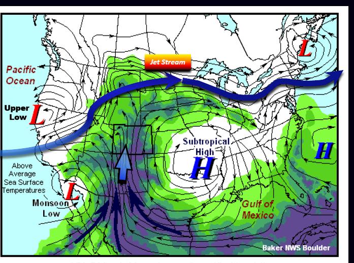
The North American Monsoon (or NAM) is a shift in the wind pattern that allows for continuous moisture to flow from the Gulf of California into the normally arid southwest region of the country. This usually happens when a strategically centered high pressure (with clockwise flow around it) and low pressure (with counterclockwise flow around it) settle in over the region, like the first picture shown.How do we know when it's monsoon season?
 Over the southwestern United States, the NAM typically ramps up in July and persists
through August. While you might observe
some occasional wet days before it arrives, or some drier days after it's arrived, a
fairly persistent, large-scale pattern will emerge. For example, you may notice that dewpoints throughout
the southwest are more often in the upper 40s and 50s (but earlier in the summer had
more often been much lower, in the 30s or below!).
Over the southwestern United States, the NAM typically ramps up in July and persists
through August. While you might observe
some occasional wet days before it arrives, or some drier days after it's arrived, a
fairly persistent, large-scale pattern will emerge. For example, you may notice that dewpoints throughout
the southwest are more often in the upper 40s and 50s (but earlier in the summer had
more often been much lower, in the 30s or below!).
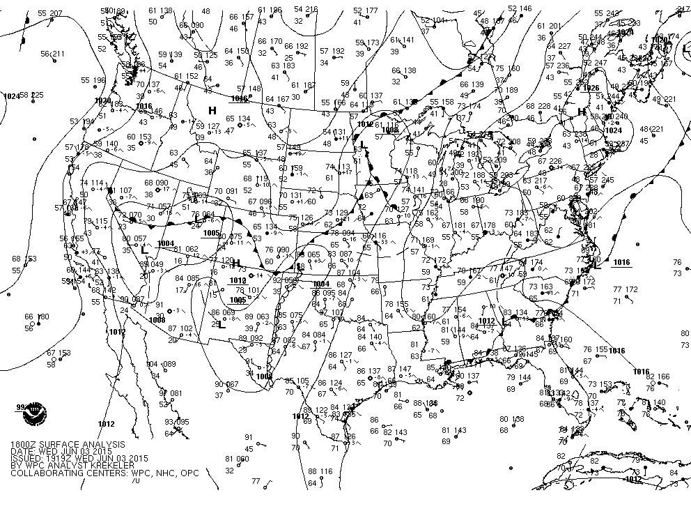
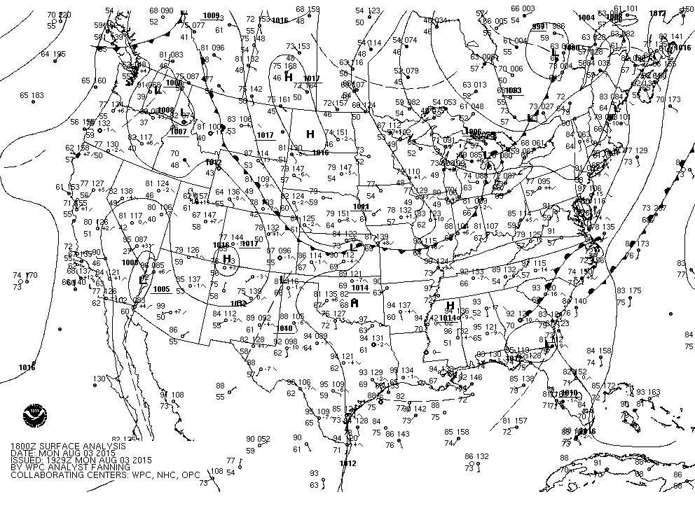 Click on the surface map images to the right, and check out the differences in dewpoints throughout Arizona, New
Mexico, and around the Four Corners region. The first surface map is from June 2015 and
shows dewpoints in the teens and 20s. The second map, two months later, shows dewpoints
in the 50s, with a high pressure centered over the Four Corners and a low pressure along
the California-Arizona border.
Click on the surface map images to the right, and check out the differences in dewpoints throughout Arizona, New
Mexico, and around the Four Corners region. The first surface map is from June 2015 and
shows dewpoints in the teens and 20s. The second map, two months later, shows dewpoints
in the 50s, with a high pressure centered over the Four Corners and a low pressure along
the California-Arizona border.
Does the NAM really impact Colorado?
The NAM indeed does play a role in Colorado's late summer weather pattern! A typical monsoon pattern shows the greatest precipitation anomalies extending from Arizona and New Mexico and past the Four Corners (your geography lesson for the day: Colorado makes up the northeast corner of the Four Corners). Depending on the strength of the NAM, and the location of where it ends up, the vast majority of the state has, at one time or another, seen the effects of the monsoon.